Saturday, October 9, 2010

Denali, Day and Night

Both of the images are High Dynamic Range (HDR) that represents most of the visible world, therefore some what you see may be bit unnatural. I did the HDR using Photomatix 3 Pro. Then I opened them in Photoshop CS5, cropped them, applied curves to correct colors and finally sharpening. The above image was taken at Wonder Lake, near Mile 85 of the Denali Park Road. While I was there taking the images, another photographer stopped to tell how lucky I was; he has been coming here for the last 27 years and never seen Mount McKinley so clear, not a cloud in the sky. Maybe I was lucky twice; I also won the Denali Lotto which permits winners to drive their own vehicles for a day inside the park beyond Milepost 15. This is allowed once a year at the end of the season for about 4 days. Other than on this occasion, one has to ride a bus past the gate at Milepost 15 at the Savage River Bridge. Due to the restrictions of the blog, I was unable to properly size the images but if you click on them, a larger image may be available depending in your settings.

What you see above are the Northern Lights or Aurora Borealis taken near Denali. This image is also HDR but with a different twist. When using HDR, one changes the exposures to obtain more detail of the dark and light areas of an image. In this case, I did not change the exposures but I rather used time intervals to capture the changes in the lights, as they expanded and contracted across the sky. This technique may be called stacking by some. Since I could not cover the lights across the sky using a 16-35 mm lens set a 16 mm, I used another secret trick of mine (well not secret any more after you read this). I just set the camera in the tripod with the lower left corner and the upper right corners of the viewing frame aligned with the horizon. So I am really splitting the frame with an imaginative diagonal line and aligning that line with the horizon, then I crop a bit the ends to make image rectangular. The University of Alaska has a website that predicts the probability of seen the northern lights (http://www.gedds.alaska.edu/auroraforecast/) and I relied on it to wake up in the middle of the night and search for them. It worked for the night when this image was taken. While at ANWAR, where the photos of the bears of the previous blog were taken, this site showed very poor probabilities of seen them so to bed I went. When I woke up the next morning, the first thing the guide tells me is about the extraordinary northen lights seen that night. These were in the form of waving colorful curtains that cover most of the sky. So when I asked him why he did not wake me up, he responded : "You told me that you came to see Polar bears."

Monday, October 4, 2010

Polar Bears

After traveling more than 10,000 miles by land, air and sea, I am back in Virginia after meeting with Polar Bears in the Alaska National Wildlife Arctic Refuge (ANWAR). They are the ultimate predators and being close to them with not protection, other than a guide with a weapon was unnerving. Although I have been in the proximity of lions, elephants, rhinos and leopards in Africa, there I was sheltered by a vehicle that could speed away from danger. In ANWAR, I was on foot on land with no chance to outrun the bears, they can do 30 miles per hour; more than than the 5 that I can achieve over a short distance. The outcome is obvious.

I saw about twenty bears, with several females having 2 cubs each, do not know is that is the usual number. On one occasion, one family approached in an inquisitive manner since I am still here; if the mom who have wanted to provide the cubs with a dinner, I would not be here writing this blog.

One of the cubs was extremely curious and came within 20 feet and performed by standing in its feet and moving the arms as umpire signaling in a football game. Another found a white feather, which it examined closer and then started playing with it.

While searching of the bears in a small boat, ran into two bears swimming and was able to photograph them. They showed not interest and continue on their way. These animals are large and can swim hundreds of miles, one raised its body about 3 feet above the water to look around. I am quite sure that if they wanted, they could have come aboard the boat or turned it over and get meals inside. I had been many places with wild animals, but no where with the level or risk or excitement that I had here.


Sunday, September 12, 2010

Winter in the Southwest

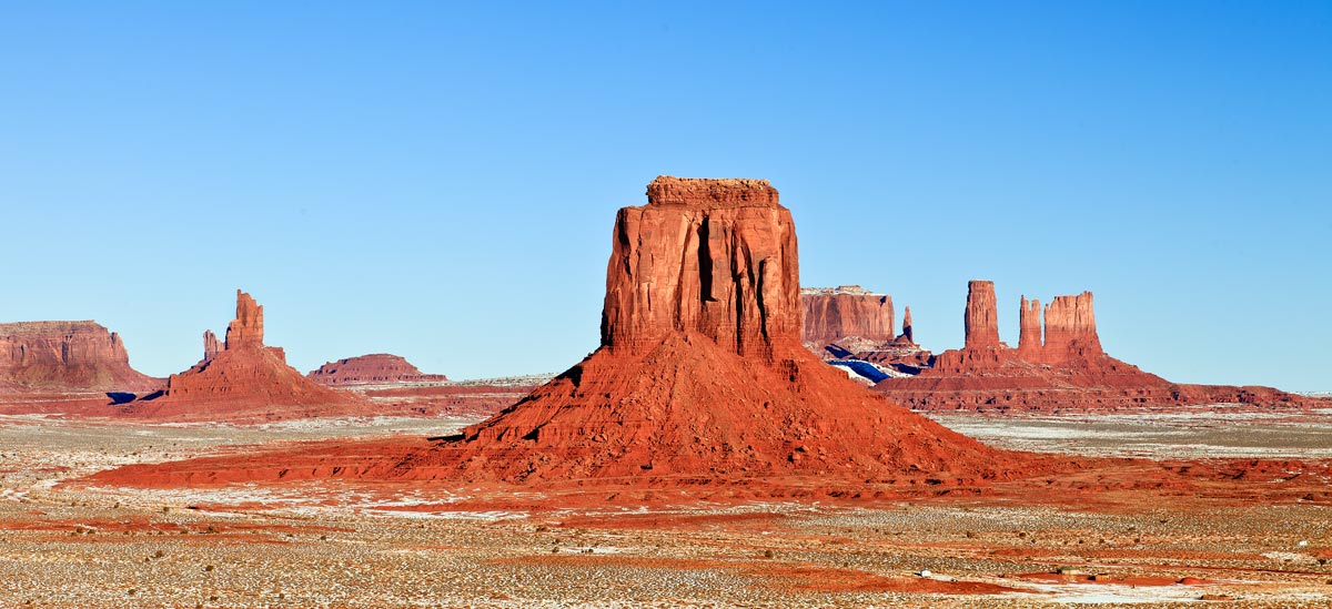
I was in the Arizona and Nevada early in the year. I decided to blog now with these images because it will be a while before I have another chance. Monument Valley is one of the most photogenic sites in the USA. It is vast and interesting because of the topography and driving with snow is tricky, although it looks as there is not much of it.

The predominant red color of the Southwest is challenging to manage, it is either over or under saturated. The desert is mostly deprived of vegetation and other than short grasses, one may encounter a lonely dead tree. You wonder where all the water has gone considering that the mesas were created by water erosion.

While driving from Monument Valley to Page, I passed this windmill and continued but had a change of heart and returned. I had to capture the painting on then tank of a typical western scene, it just fitted perfectly in the landscape. The itinerant artist who created the scene left no marks as to whom he was, might was well, in the desert nothing last long.

I was at the Antelope Slots two years earlier in late summer. I just wanted to see how different the lighting was in the winter; quite honestly, there was not much of a change in brightness or coloration inside the slots
but there was nobody else there to disturb the sand creating a dusty air. Below is and image of the surface above the slots, I guess not many has seen it in photos since most of the photogenic interest is underground.

Next is an image which is most familiar, since hundreds of photographers come to the Slots yearly to capture the “Award Winning” photograph. Mostly what you see printed, is not what they really look like because of the difficult lighting conditions and the artistic freedom provided by Photoshop. Most of us processing images have a different recollection of what the “true” colors were. What the eyes see and the mind remembers is not what the camera records. Regardless, the hues and the textures captured are pleasant.

The southwest had a record snow fall that caused great damage and blocked major highways for days when I was there. Fortunately, I was able to enter the Grand Canyon from the northeast. Walking to the edge of the canyon with 24 inches of snow was tedious; the tripod became the third leg that allowed me to reach the edge. But there was nothing to fear, I ran into two park rangers on skies patrolling the rim ready for the rescue. Was the walk worth it? You decide. the result is below.


Friday, August 20, 2010

Troheim, Norway

Trondheim was the first capital of Norway with gothic cathedral. What is it doing here? I associated this type of construction mostly with the territories that were once the part of the Roman Empire; but the Romans never conquered the Nordic countries. The Nidaros Cathedral construction started back in 1070 and in the Middle Ages, was the northen most center of pilgrimage, rated in importance as equal to the cathedral in Santiago de Compostela in Spain.

Being near a Cathedral on a Saturday, is hard to miss a traditional wedding parties. Here we have a young couple set against the wall being shot by a squad, luckily by using cameras.

And what is a city without a Coat of Arms? Just a manhole without a cover, waiting for people to stumble into it. It dates back to the 13th century and included the two most important characters of the time, the Bishop and the King. The Bishop at the cathedral looking towards the King at the right in his castle, holding the scales of justice. They seem to be standing over the bridge beneath which there are 3 heads floating in the water awaiting for the dictates of the potentates above.

Just across from the front of the cathedral, there is a park with some interesting scultures that are a challenge to interpret. The first one looks as a Maya sculpture with two seating man at the base topped by a golden mask. Something that I would expect to find in Chapultepec Park in Mexico City.
The other, that of a man with what look like cacao pods growing out of the body. The larger one ends in a basket with a head within. Those long cold and dark winters provide the Nordic artists with plenty of hallucinations to create strange works of arts.

Trondheim is a seaport where the Nidelva River drains into the ocean. Its banks are covered with rows old storage warehouses resembling those in Amsterdam, with the difference that here they are wooden and built on stilts.

Another similarity with the Dutch city is the abundance of bicycles (I found one with the color stripes of a bumble bee) and tulips. Tronheim was a welcome surprise and pleasant city to visit.


Monday, August 2, 2010

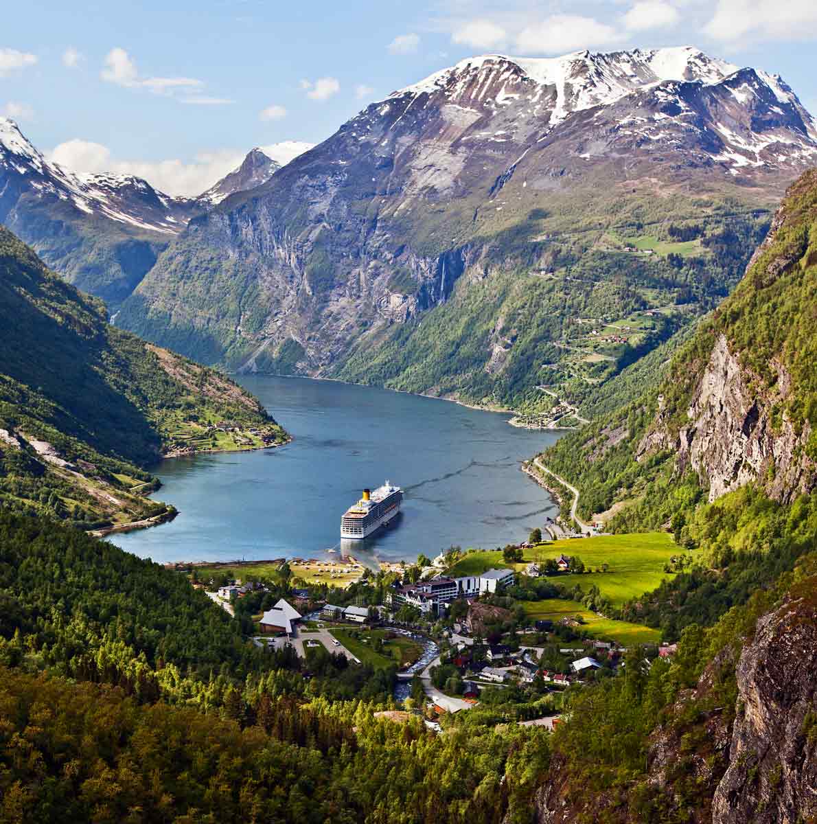
Hellesylt to Geirangerfjord, Norway

Hellesylt, Norway, a very small town that is overwhelmed by the size of the waterfall that feeds into the Sunnylvsfjord. It was the departure point for a drive to Geirangerfjord.

First stop down the road was an old stone bridge built in the late 1700’s by the King to expedite the mail deliveries, it is not used for road traffic currently. There were other similar bridges from the same era but smaller along this road that follows the shores of Lake Hornisdal that at 514 meters is considered the deepest in Europe.

There nice landscapes along this road with farming communities and at Grodas, I found a Best Western Hotel. This one was different since it has an attractive architecture not typical for this type of accommodations.

Down the road, I arrived at the village of Stryn, with a bridge across the river where the shore covered with very colorful houses are located as seen below.

Stryn is definitely a tourist town, most other villages shops were closed on Sunday, but not here. Everything was available such sheep skins, smoked salmon and a variety of honeys. And the parking lots were full of buses, as the one pictured below, I find buses in Europe most fascinating due to their decorations.


We had a stop at the Jostedalsbreen Nasjonalparksenter; let me count: two words and 32 letters. It was by the side of the lake with a stream to the side. The main building has displays of the local fauna, flora and geological formations. It has a well kept garden with trees and shrubs in full bloom when I was there in June. An enjoyable place with no “entrance fees.”

Soon after, the road started climbing up the mountains covered with snow. This is a serious road, with 180 degrees turns and at times, the road is surfaced with gravel with snow banks to the side serving as protective barriers (illusion) to prevent vehicles from falling into the valley below. The thrill was when a bus was coming in the opposite direction leaving hardly any space to pass, having to squeeze over the snow banks hoping that they would hold.


This road climbs 5,000 feet to the top of Mount Dalsnibba, offering spectacular views of Geirangerfjord. It seems to be a very popular location and several families were having picnics; of course you must be Norwegian, it was extremely cold and windy to lid a fire, cold smoked salmon with hot chocolate will do.


Looking down, the winding and twisting road that brought me here, is waiting for the return trip. A worthwhile drive but not for the faint at heart.

Sunday, July 11, 2010

The North Cape, Norway

The North Cape claims to be the northernmost point of land in Europe. But is it? Like most other records, it is claimed by others and in this case, Knivskjellodden and Cape Nordkinn. In reality, the North Cape and Knivskjellodden are in the island of Mageroya, while the later, in the European Continental landmass proper. You decide.

To get there, I landed at Honningsvag that claims to be the northern most city in Europe. Then I headed north to the North Cape and made a stop at an indigenous people trading post, the Lapponian Camp, where there was a “Teepee.”

It happens that the Sami, the indigenous people of the Nordic countries, use this type of shelter called a Lavvu. What jumped to my mind was the similarity of the Lavvu to the Teepee of the North American Plain Indians. I propose that design similarities were the result of both cultures being nomadic, in need of portable shelters that could be easily set-up, dismantled and transported. They depended in migratory animals for their survival; the reindeer being to the Sami what the buffalo was to the Plain Indians.

Once at the North Cape, the landscape was barren with steep cliffs down to the rocky shore. One could be at any other place in the world at similar latitudes and could not notice any thing naturally peculiar about this place. Points of interest here were recently created by man for the benefit of tourists, who bring income to the area in excess of the traditional fishing industry. As one arrives, the large North Cape Center building with shopping stores, restaurant and museum is the dominant structure. There is a Thai Room in memory of King Chulalongkorn who visited in 1907; I least I have something in common with royalty, the curiosity to travel.

There are seven round monuments that look to me as giant old greek coins. They are called the “Children of the World Monument” and each of was designed by a child from a different country who visited there as guests of the Norwegian government in 1988. They are to promote peace, happiness, friendship, etc.

There is also a statue of a woman with a boy pointing south (according to my bearings) and she may be saying “Go South Young Man.” where is sunny and warm.

While walking by the cliffs I noticed a carving on a rock that looked to me as an insect. It was just there, no marker or fence to protect it; I am sure that I am not the only one that has seen it. I just photographed it and did not think about until I got home. I was intrigued by this lithograph and emailed the image to the North Cape Center. Surprisingly, Khristian, the service manager at the Center, was kind enough to respond and said that it was called a “rune.” Runes are a type of writing derived from ancient italic alphabets. It is tough that it was introduced by returning Germanic mercenary soldiers that served in the Roman Imperial Army. So what I tough was a representation of an insect is a group of rune letters. Would like to know what it says, anyone out there can translate it for me?

It is time to depart for new latitudes and after a last photo of the Cape, I return to Honningsvag, where at the port, I ran into a group extreme explorers fitted in space suits to conquer the “Finis Terrae.”

Friday, July 2, 2010

Lofoten Islands, Norway.

After a while, new places do not look so different from others in the world. The Lofoten Islands reminded me of Iceland, Alaska, and southern Argentina as well as Chile. It is all location and in this case being close to the Artic or Antarctic Circle. It seems that the weather dictates the landscape as well as the building construction. Most buildings are painted red or other vivid colors; and these are mostly built of corrugated metal sheets or wood. And of course, the major historical source of wealth is the fisheries. In the case of these islands as in Iceland, cod fish.

The islands are one of those places that as Patagonia, Torres de Paine, and East Africa, I would like to return time and time again. These islands are scarcely populated with beautiful land and seascapes, picturesque fishing villages and old churches, small farms and not environmentally spoiled. And the weather is perfect; it changes every fifteen minutes—imagine the photo opportunities. I was here in mid-June and it was cold!!!

I had lunch one day at the Maren Anna Restaurant in the fishing village of Sorvagen and was named after a fishing boat that moored at its pier. It has a prominent sign stating that it was close but it was not, I assume that it has recently opened for the tourist season starting in June. It also has rooms for rent. It has a buffet line and I explored the local delicacies, one in particular was intriguing, cod tongues. I rather say that I preferred the wonderful smoked salmon also available as well as reindeer stew and potatoes, I wonder what people ate before the Spaniards brought the potato from Peru to the old world?

Below the bridge over the small creek that provides access to the restaurant, I saw this old rusted cast iron turbine, so down I went to take a closer look, I found that it was used to generate electricity and was first put in use in 1916 to generate electricity for the fishing processing operations in Sorvangen. If you take a closer look, there is a metal plate in the turbine with the following information: Model #177, VAPLANS MEK, Verkstads A.B., 19-NALDEN-09.

Next to the restaurant there is a pier still along with storage buildings in use today for fisheries operations and as nesting for black footed kittiwakes. These birds are quite oblivious to the presence of humans and quite noisy. According to the locals the restaurant was originally a cod liver oil factory and then a cannery

Driving down the chain of islands that have been recently connected by a series of bridges and tunnels, I passed a larger fishing village, Reine. It is located in a cove with a wonderful range of mountains as a background; one of those photogenic places in the world that everyone passing by has photographed. Don’t believe me? Just google Reine and see how many similar images as the one above you will find.

There are lots of fishing villages as you meander along the narrow roads, some are abandoned and others are still in use. And then there is A, a preserved fishing village which is now the Cod Museum in Sorvagen. It is a wonderful place and cod is still processed and hung in racks for drying. For more information go to: http://www.datadesign.ws/nfmuseum/museet.htm
And there is nesting colony of black-footed kittiwakes in the steep rock cliff right next to the piers. Since I was there in June, the birds were just fighting for nesting space.

The Lofoten Islands have a long history of human habitation who earned a living out of the cod fisheries and up to this day, is the major exported of dried codfish to Europe and
Africa. So far, the cod population is not threatened with decline as in New England and the Maritime provinces of Canada and not the subject to cod wars as those that has regularly taken place between Iceland and Britain. The Lofoten fishermen has diversified and developed extensive salmon farms, just as it has been done off the coast of Chile and Scotland. But fishing today is not the major income of these islands. Tourists like me, are their major catch, generating more income than the traditional fishing industry.