
This is the first time that I get to visit Montana by starting in Great Falls and driving NW via Rt.89 towards Glacier National Park thru mostly an agricultural area that has been better economic times, most of the towns showed significant signs of neglect. At Fairchild, I ran into an enormous conglomerate of silver silos. They are owned by Anheuser-Busch brewery…imagine the millions of gallons of beer that will be brewed from the grain stored in this silos.

Continuing in Rt. 89 I ran into Bynum, kind of a mecca for
dinosaurs lovers. There is a museum and
a store that sells rocks and fossilized bones.
And of course lots of dilapidated buildings that were probably there
when Tyrannosaurus rex roamed the streets chasing humans.


The landscape past the above town turns wheat fields as far
as the eye can see and soon found myself in Indian lands. If you don’t behave
the braves will chase your car in horseback and get it full of arrows as if
were a buffalo.


At the town of Browning, I turned into Route 2 going west
and soon found myself in a mountain road bordered by a thick forest, this roads
parallel the railroad tracks built back in the 1930’s in the Marias Pass to cross Rocky Mountains in Essex.
Nearby is the Izaak Walton Hotel, built in 1939 as a concession from the Great
Northern Railway. It was originally used to house the crews who cleaned the
snow off the railroad tracks at the Marias Pass. Now it is working hotel and railroad museum. It
was built by 12 carpenters in 3 months; what an accomplishment. Behind the
hotel is a large railroad yard still in use. The red caboose is now a guest
room; notice the wheel detail and the two belts used to rotate the dynamo in
the upper right. It generated
electricity for the car when moving. Further down the road, there is a park
celebrating the Lewis and Clark Expedition and President Roosevelt. The statue is that of John F Stevens, the
engineer who mapped the pass in 1899 and twho designed and constructed the
railroad tracks to cross the Continental Divide.


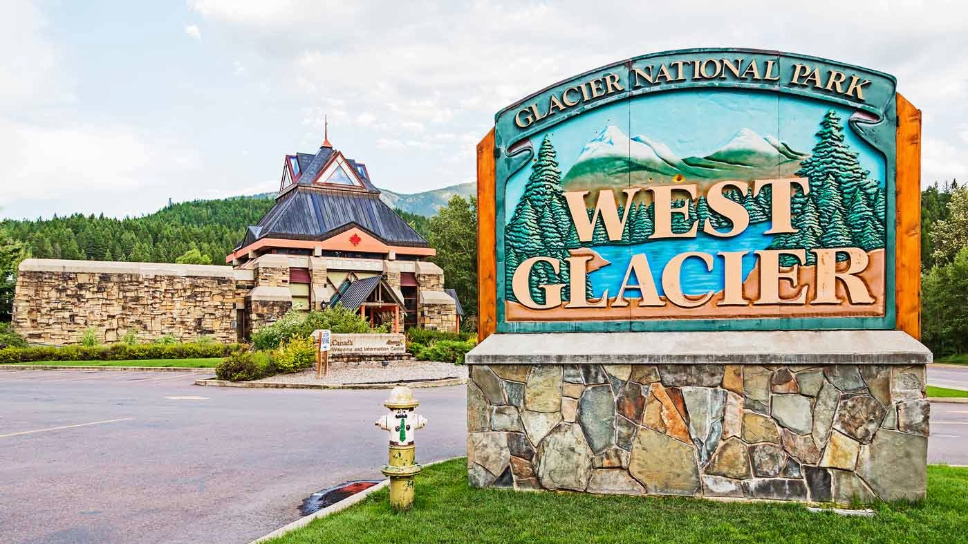
Finally arrived at Glacier National Park. As all parks out west in the summer time, it
was crowded with traffic jams made worst by the highways repairs that were
taken place at the time. Drove up to Logan Pass, located at an elevation of
6653 feet where a large Tourist Center is located. From here you can walk through the meadows
where the ground squirrels and marmots are habituated to the tourists and are
easy to photograph.


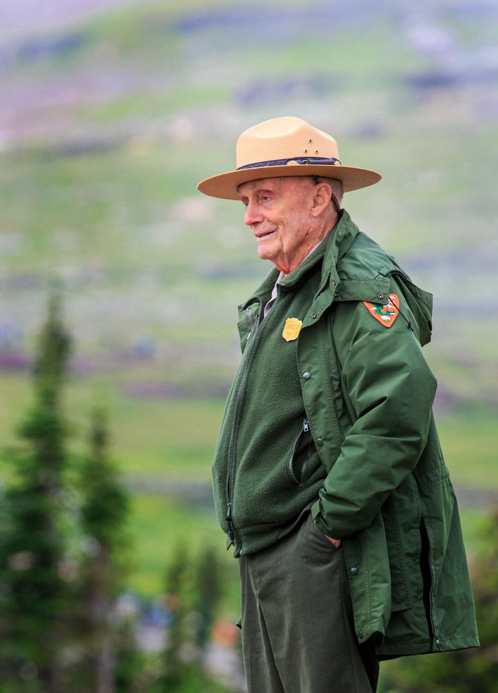
The place was overwhelmed by nature lovers and wanabee
wildlife photographers that would abandon the trails to get a closer view or shot
of some flowers by trampling other… and the ever vigilant Park Ranger, Mr.
Douglas Follett chasing the trespassers back into the trail. He is approximately 87 years old and started
working for the Glacier National Park Service in 1942… that is a long time. He is sharp like a tack and can tell you the
name of all the flowers, animal and birds in the park; he also claims to have climbed
all the mountains in the park back in his younger years. Quiet a personality and a National Treasure.


I traveled the main road within the park between the West
Glacier Gate and the St. Mary Visitor Center twice and the most exciting thing
to be seen where the glacier carved valleys and a multitude of waterfalls. Unfortunately the glaciers are mostly gone or
basically non-existing, and I really did not see any major wildlife other than
some mountain goats at a distance; there are bears and moose these were not
seen. Overall, the visit to this park
was disappointing and a better bet will be to just to drive to Yellowstone that
I find more rewarding.


Continuing West in Rt. 2, I passed a corral with the most peculiar
horses; they appeared to be low maintenance ones since they need not attention;
just like plastic flowers. I spent the
night at Kalispell, another small Montana town but this one was busy and
alive. It has a beautiful Courthouse and
the Conrad Mansion, built by the richest man of the town back in the late
1800’s. Mr. Charles E. Conrad founded
the city and was an Indian trader and fighter and made his money as a Missouri
River freighter. The old high school was a very impressive structure.


Continuing south in Rt. 93, I ran into a Duck and a family of
bears in the town of Polson, located in the shores of Flathead Lake. Farther
down the road, I took a right into Rt. 212 and drove into Charlo, where I only
saw a dog walking the street…where have all the people gone? A closed seed store and an abandoned silo by
the railroad tracks are reminder of a more prosperous past.


Past Charlo, is the National Bison Range, there was no a
bison to be seen that day. I did into
the Range and at one of the scenery stops; you could see a valley that at one
time was the bottom of a pre-historical Lake Missoula (the name is derived from
and Indian word meaning “place of frozen water). It existed about 15,000 years and flooded an
area of approximately 200 miles in western Montana to a depth of 2000 feet in
some areas. The city of Missoula about
60 miles south of the pre-historic lake; is the home of the University of
Montana and has more micro-breweries/capita than any other city in the
USA. Moose Drool is probably the best
known beer brewed here. The wall with the sculpture is in one of the buildings
in the University and the last image, is that of the city’s courthouse. Although I started in Great Falls and ended
there; I never took a photo of the place…too busy arriving and departing from
the airport; maybe next time.


